We are at 31 35.491N 081 12.127W Google map it to see where we are. It is a lovely little creek off the ICW. Cruising Georgia is like taking a truck without a heater up a mountain in winter with switchbacks at 3 to 8 mph depending on current. After 3 days and 120 miles of travel you may have gone 50 miles as the crow flies. Major difficulty is boredom. Most of the scenery is marsh and the rivers are wide. How much swamp grass can you stand?
Friday, October 31, 2008
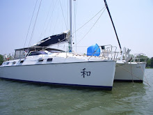
Isle of Hope near Savannah click here for map


We tried to get to Thunderbolt Marina but there was no room. The gods smiled on us. As we went by Thunderbolt, we could see crowded docks, hear lots of noise and it was poorly protected from wind and waves. On the other hand, Isle of Hope Marina is well protected with an anchorage next door, quiet and well protected. With a courtesy car we used to go to an excellent Spanish restaurant about 5 miles away.
It is still very cold, especially in the mornings. I am so tired of wearing socks.
Monday, October 27, 2008
Church Creek Click here for a map
Church Creek is about 20 miles West of Charleston after a windy path with currents 2 to 3 knots against us then 2.5 with us so we went from 3 knots to 9.2. What a ride. Last night was in a little creek 20 miles east of Charleston. Then we stopped over at Isle of Palms, SC and got gas, had a much too short visit with Bill Temple, a friend from High School, and got on our way. The visit was much too short but it was the best the circumstances would allow. Maybe on the way back.
Saturday, October 25, 2008
Good services
As much as I complain, it is nice to deal with competent people such as John Pate whose email is FortAwesomeIII@gmail.com. He is the one you get the Winchbit from if you can't find it on EBAY. In case you forgot, the winchbit is the better bit for a drill to operate the winches.
The second person is the mechanic we just had. He laid on his magic hands and both engines and the electric charger now appear to be working. He came to our boat in Georgetown but also gets down at least as for as Isle of Palms and probably Charleston. His name is Sarkis Keuleyan at SeaTec Systems. Telephone 843-546-1401 and the website is http://www.seatecsystems.com He does engines and electronics and I highly recommend him. Click on the title here for a link to his site.
Waccamaw River
10/23/08 (click on title for a map)
Today we motored from Barefoot Landing, almost on the N/S Carolina border, down the Waccamaw River to Georgetown, SC. The farther southwest you go, the more cypress you see. These fascinating trees grow out of the swamp from a cluster of conical roots that eventually merge into straight, tall trees with small leaves. Most of them are dripping with Spanish moss. We passed Bucksport, one of Florrie's favorite spots in this Low Country. It is the area that inspired one of the pastel drawings in the slide show on this blog.
Here's an excerpt for Florrie's daily journal: We're moving too fast for me to make on-site drawings but maybe I'll be able to do some from memory. The cypress are spectacular. One old gray tree looked like a wraith with a gossamer cape and billowing skirts striding from the water into the forest. Another looked like an ethereal leaping dancer with her "costume" trailing behind. The moss looked like wafting hair. It was both spooky and beautiful. It took awhile for me to realize that the rounded triangular shape of the woman's heads were actually the abandoned nests of eagles built into the topmost branches of the near-dead trees.
There were also totally denuded cypress snags, trees so long dead they had no bark and were completely light gray. They loomed out of the water with holes big enough to look like tormented eyes and mouths. Limbs reached out like arms, twisted in grotesque positions. These also wore tattered moss "garments" that billowed in the breezes. Old cypress are often hollow so the trunks had deep dark gashes that accented the length. The effect gave the whole scene, even in mid-day, the effect of a forest full of Halloween specters. Imagination could run wild here. It is Tim Burton's Paradise!
Sunday, October 19, 2008
Milwaukee drill
I have been asked about the drill bit I use for the Milwaukee drill (see one of the early posts about my favorite tool). It is called a "winch bit" and it is still on EBAY. click the title above for a link to it within the next few days or go to EBAY and search "winch bit" or "winchbit". It is soooo much better than the other bit for winches that it is worth the additional cost, about $50 including shipping. The other bit has a round shaft and slips under pressure so it does work under light load but not under the pressure I need to bring in a jib on a windy day.
Saturday, October 18, 2008
Waiting out the front
(Local weather...click on title above)
We have a front coming through (long pants and even socks!) and are sitting at the dock at the Morehead City Yacht Basin. Google it and see the location. If you are too lazy for that check out the Blog below and click on the title to see a map of the area and specifically where we are. Winds are building and some rain. Small craft advisory until Monday then we leave. Hopefully the bridges will open as the winds are still predicted to be up to 25. Also hopefully there are no planned activities at Camp Lejeune until the reported ones on Thursday when we should be past there.
We have been travelling with a couple on a Catalina 42 so we are not alone.
The engines have been working...knocking hard on wood. We did have an overheating problem on the port one but with Florrie taking the helm while I put some more oil and coolant in, it and she responded well. Refridgeration is still kind of iffy. Both the fredge and freezer work off the same switch so we have a cold freidge and a less cold one. The freezer isn't really good enough to be called that but WILL keep ice for 4 to 5 days and the rum is holding out. It doesn't get much better than that.
Thursday, October 16, 2008
Morehead City, NC
Here we are for awhile (click on the title to see the map). There is a front coming, probably tomorrow night, and we are tucked in for the duration of the passage. Looks like until Monday. We are safe and warm here and there isn't really a good spot for hight winds for 100 miles going south. Hurts the cruising budget but not as much as salvaging the boat off the rocks somewhere.
For those interested, the floating docks are in great shape, the showers are wonderful, the protection is amazing except for wind fron the NW but waves are blocked. It costs $1.75/foot daily or $8.50/foot weekly with a very good resturant within walking distance and you can "rent" their car for $10 for "a couple of hours".
Tuesday, October 14, 2008
Bonner Bay
We have no email or cell phone so I’m writing this in a word program to send as a blanket email later. We’ll see if the Broadband will work. We have Lew’s two laptops. This one gets broadband. The other gets WiFi. That might explain some strange transmission lags now and then.
This was almost a "girlfriend alert" but the day turned out better than the overly domestic drudgery of the morning. The refrigeration works 1000% better than last season but it is still a challenge! That is on my "Grump List". Yes, I started lists again but this time the "good list" is getting longer. For one thing, Lew & I seem to be getting along a whole lot better. Last trip was very stressful for both of us. At least this time around we have some of the contingency plans worked out ahead of each crisis. We’ve met a few people on their First Long Trip together. It doesn’t matter how many years they have been together, it is usually the trip from hell. The divorce rate is 25-30% after the first trip. Honest. But the second time, if you haven’t killed eachother, is actually a lot easier! Let’s hope I can still write this as easier by next April!
The boat is behaving beautifully these days. The weather has been fine. The two nights of higher winds we were on the dock/sea wall at Elizabeth City, NC. What a lovely, friendly town. I could stay there for a week! But we moved on. Last night we were anchored on the Alligator River, tonight we are anchored in Bonner Bay, about 20 road miles north of Oriental (which you might find on a map). Pretty soon, we need to be tucked in some place safe for the weekend because there’s "weather" expected. One of the Named Tropical Storms is supposed to make it nasty travelling for a few days. We’re probably going to try to stay at the Moorehead City Yacht Basin. It was a good place last spring. We’ll get there tomorrow and stay... Unless we find a good place a day or two south, before the weather hits. When it passes we will go on.
Today is day 11 of our trip that started in Keyport. Because of weather and the hole in our boat, last spring it took us 37 days to get home from here! I guess that might give you a little idea of how much easier the trip is this season. Even thought getting ready to leave was crazy-making, we seem to have finally put away all the things we brought on board. We even did laundry in Eliz. City.
Last spring we were traveling with "Puff", now we’re travelling with a bunch of new friends we made at the lock at the north end of the Dismal Swamp Canal. "Royal Serf" has been our trailblazer since then. "Honeywind", "Illusion", and "Brio" are still with us, I think. The trawlers zoomed ahead. We may see them in the Bahamas in the winter. It is very nice to see friends across the water. At night our anchor lights make a lovely constellation above the horizon. Last night was a full moon. THIS is the stuff postcards are made of!
On last thing: I just finished "I am Madame X" by Gioia Diliberto. It is a very interesting novel about the woman who sat for John Singer Sargent’s most controversial portrait. It passed the days when all there was to do was go south. Now I hope to get a little painting and drawing done.
Sunday, October 12, 2008
Elizabeth City, NC

We are now sitting in Elizabeth City waiting for a more northerly breeze to cross the Albemarle Sound. These pictures are from the Dismal Swamp. Click on them for enlargements.
Friday, October 10, 2008
Dismal Swamp Canal

Yesterday was a very easy day. We left Norfolk and went up to the Dismal Swamp Lock for an 11AM opening only to find that the 11 and 1:30 were both cancelled. We anchored and waited for the 3:00 opening. After going through we tied up to a dock for the night rather than rush to beat darkness to get to the visitors center. Total mileage for the day...10.
Today we were up early and had coffee with the lock master. Made the 9AM bridge opening and got as far as the visitors center by noon. Another 18 miles. Can the human body stand such acceleration.
To see where we are, Google Earth and insert these coordinates:
36 30.409N
076 21.360W
Wednesday, October 8, 2008
On the road again
Jimmy left us to fly home yesterday at 3:30. What a treat to have him with us. We had a very good 52+ hours in the Ocean, coming straight from Keyport to Hampton, VA. It is so much easier to do overnights with three people. Jim & I had a chance to get to know each other better with our wee-hours chats. My watch was 3 - 7 AM and his was just before that. He's become a really neat man. What a pleasure. AND Lew hoisted Jim up the mast and now we have an anchor light - finally! THat is a real treat, too. We had been making do with whatever lights we could set up on deck - which isn't really a great idea.
We're hanging out here at the dock for most of today. We'll enjoy a nice shower - for the last time in a few weeks probably. Sigh. It is SO much easier this trip. We made whatever adjustments we needed to last year, under near-crisis conditions so this year we aren't as stressed when something isn't what we thought it would be.
It has been 40 the last three nights, I think, but we have terrific quilt/sleeping bags so have been fine. Days are sunny and very pretty. This may be our best WiFI for awhile. On THursday morning we head down the Dismal Swamp Canal - one of my favorite places on the trip - but I don't remember what kind of email connections we got there last spring.
Thursday, October 2, 2008
Island Images by Florence B. Hill

Treasure Cay Beach was painted on site in January 2008. This was the first of 17 acrylic and four watercolor paintings as well as seven quick pastel studies created by Florence B. Hill, better known to friends as Florrie. Enjoy the slide show to the left. Those images are available in gliclee prints. For fun, Florrie and her friend Lisa printed t-shirts and totebags of some of the images.
Subscribe to:
Posts (Atom)