Norfolk to St. Augustine at SpotAdventures
Map created by SpotAdventures:GPS Geotagging
We (crew of Terry Parker and Gordon White) started out in Norfolk, Va when MOAA predicted a nice weather window with winds from the NW. Of course the actual wind was from the SE and on the nose. But if was light so we continued on down the Virginia coast past Virginia Beach and the Outer Banks NC. The wind did swing around to the NE and we had a nice sail/motor-sail for awhile. The starboard engine (that is the good one) overheated and we went on the port one while trying to fix the starboard one. The engine was pumping plenty of water so it wasn't the water pump or impeller. Finally we figured it out that the fan belt had broke. No problem. I had asked Florrie to pick up a couple of spares and they were on the boat. Sure! They were too small. We did gave one of these "link" fit any size belts which did actually work and around Cape Hat eras we went. The wind picked up and we got to sail...up to 10 knots down the 3 foot waves. After a few hours the wind died and we put on the engine again. Broke the belt several times. After about four hours working on it we were off Cape Fear and it seemed like a good idea to go in and get the engine working. By this time it was about 9 at night and we were 7 miles out. I didn't want to come in to the Cape Fear River at night so we Hove to. For those who don't know, heaving to is when you have the jib on one side and the main on the other working against each other. The main fills and drives the boat up into the wind where it luffs and the jib catches on the other side and drives the boat backward. You maintain this see-saw motion while the boat is pretty much sideways to the waves and end up going down wind at about 1/2 knot per hour. Effectively you are stopped and if the waves are not too steep, it is quite restful and comfortable. We stayed like this for 5 hours while I got some sleep. I woke up with what I thought might be a solution. The belt was about 1 inch short even with the alternator loosened all the way so I forced the belt over one of the pulleys with a couple of screw drivers and it was on with a little play. Tested it out and it worked like a charm. Set up the sails and we took off for Charleston at 8 knors. We had a nice motor sail and got into a slip in Charleston at about 7 PM. Tied up the lines and 15 minutes later the skies opened up and the Nor'Easter began. You remember...the one which joined up with Hurricane Ida and tore up the coast of the Outer Banks, Hatteras and Virginia Beach with 77mps winds and 18 foot waves.
We sat it all out while watching the weather channel at the bar and thanking our lucky stars. Three days later it was over and we took off about 6:30 AM. Got some fuel and rode the tide down the Charleston River to the ocean and headed SW in a light SW breeze. The trip to St. Augustine took 28 hours of ocean motor sailing. We could have sailed but I wanted to make sure that we got into St. Augustine during the daylight hours. Good thing as the shifting sands at the entrance means that they have to keep moving the markers and they are not on any of the charts. On top of that, NONE of the entrance markers have lights. We made the 1:30 opening of the Lions Bridge and motored up to Oyster Creek Marina on the San Sebastian River just behind St. Augustine. I left the boat there and hoped on a train from Jacksonville to Newark, spent the night at home and then drove to Maine for my Niece's wedding.
Friday, November 20, 2009
Thursday, November 12, 2009
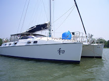
Catamaron Harmony. More on the trip
This link takes you a Google Earth map of our trip south showing the "check ins" we sent to the wives and a small section of the track where we were doing over 10 knots at times.
Wednesday, November 11, 2009
Charleston, SC
Click on the title to see us. Use the "satelite" function.
We left Norfolk on Saturday and went outside around Cape Hateras. On the nose for the first night with a bang bang here and a bang bang there.... The waves would go between the hulls and up hitting the underside of the boat and slaming under the table in the salon. Cleared the papers, etc off the table quite quickly. Not a fun night but then it swung around some and we had some pleasant motor sailing. Had some enging problems on Friday night so we hove to and rested for a few hours to regroup just off Cape Fear. I figured it out while asleep and during my 12-3 watch fixed the engine and we were on our way. Winds on the quarter and speeds down the waves up to 11 knots. Got into Charleston about 7PM, after dark trying to find the correct lights among the hunbdreds of distracting lights. Finally a good nights sleep.
Friday, November 6, 2009
FW: Check-in/OK message from LewHill SPOT Messenger
> Date: Fri, 6 Nov 2009 18:45:39 +0000
> From: noreply@findmespot.com
> To: Lew_Hill@hotmail.com
> Subject: Check-in/OK message from LewHill SPOT Messenger
>
> LewHill
> Latitude:36.92223
> Longitude:-76.18909
> GPS location Date/Time:11/06/2009 13:45:54 EST
>
Click the link below to see where I am located. or on the title of this message:
http://maps.google.com/maps?f=q&hl=en&geocode=&q=36.92223,-76.18909&ll=36.92223,-76.18909&ie=UTF8&z=12&om=1
> Message:I'm doing fine. Just letting you know where I am.